


Route Corunum reconnaissance 1

fxhedon
User

Length
5.7 km

Max alt
1552 m

Uphill gradient
103 m
Km-Effort
8.8 km

Min alt
1019 m

Downhill gradient
628 m
Boucle
No
Creation date :
2021-07-05 09:16:48.0
Updated on :
2021-07-05 12:21:19.223
2h57
Difficulty : Medium

FREE GPS app for hiking
 SityTrail
IGN / Geographical institutes
SityTrail Plus
The world is yours!
About
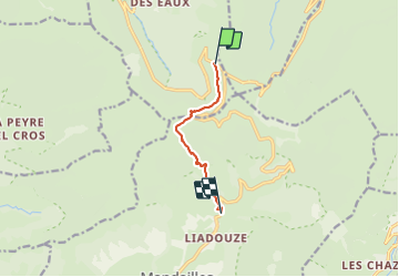
Trail Walking of 5.7 km to be discovered at Auvergne-Rhône-Alpes, Cantal, Le Falgoux. This trail is proposed by fxhedon.
Description
Reconnaissance corunum
Positioning
Country:
France
Region :
Auvergne-Rhône-Alpes
Department/Province :
Cantal
Municipality :
Le Falgoux
Location:
Unknown
Start:(Dec)
Start:(UTM)
473972 ; 4995876 (31T) N.
Comments